Are we crazy? Some of the cliff-falling-down signs along the Jurassic Coast are a bit scary! And we are walking along sections of these cliffs.
Lyme Regis, where Mary Anning made some of the most important fossil finds in the 19th century and people still find fossils today.
We walked along the huge concrete sea wall that was completed in 2014 in an attempt to prevent the town from falling into the sea.
Our path then diverted inland around a large landslip area returning to the coast at Charmouth before another inland diversion. Lots of people were searching for fossils on the beach below the cliffs we had just walked around.
Heading up Golden Cap, at 191 metres, it is the highest point of the southern English coast.
Great views. And a pub on the beach at the bottom for chunky chips and cider as the late afternoon sun glowed golden on the cliffs.
Chesil Beach is a 29 km long, 15 metre high ridge of shingle, aka rounded stones, with a saline lake behind it. We decided not to walk the entire distance on the path that stays inland of the lake. We did climb the hill to St Catherine's chapel near one end.
The view from the chapel toward the Isle of Portland on the horizon. It is not quite an island as Chesil Beach connects it to the mainland. This photo does not do justice to the view and it was not possible to fit the entire beach in one photo.
Zooming in on the Isle of Portland end of Chesil Beach gives a bit of an idea of the way it seperates and joins land and water except you can't see the large open harbour that sits behind the hill on the left. Sometimes you just have to be there yourself.
We drove to the Portland end and walked on Chesil Beach. It is steep, wide and very hard to walk on. The beach was fascinating. These photos do not show its three-dimensional shape or the unique way the waves were breaking or the musical sound of the stones being thrown and rolled by the water.
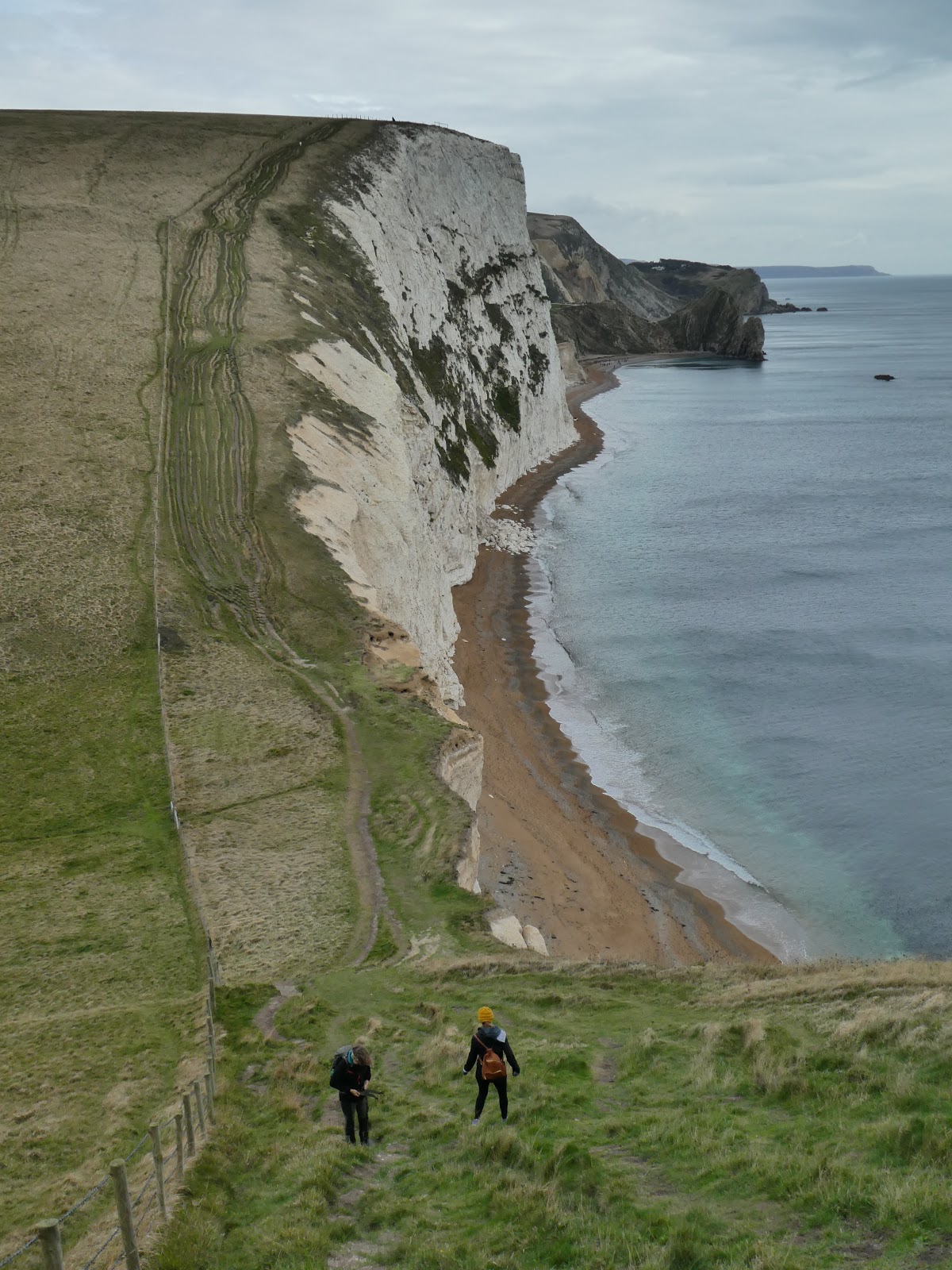
On the other side of the Isle of Portland and Weymouth is a stretch of white chalk cliffs. The squiggly lines near the cliff edges are the path we walked.
Q20507725

There were some very steep ascents and descents. The valley at the bottom pf this onecwas called Scratchy Bottom!
Durdle Door, one of the best known features along this section of coast visited by thousands and thousands of people each year.
We spent some time down on the beach. This is a quiet time of the year.
Kids climbing out of caves eroded by the sea in the base of the cliffs, part of the cliff-falling process.
Nearby is Scarehole Bottom, kayakers paddling through its multiple arches
Lulworth Cove is an almost perfect circle shape with a gap opening to the sea. Both Lulworth Cove and Durdle Door belong to the privately owned Lulworth Castle Estate which makes a lot of money from people paying to park and to stay. I suspect that yacht moored here belongs to the owner of the estate.
Fossil forest on a large ledge on the cliff below the path. The round shapes indicate where trees once grew.
Looking but not walking at the next quite long section of coast that lies within Ministry of Defence land and is not always open to the public. We chise not to walk here.
These pictures are just a few from four days of walking the Jurassic Coast.


No comments:
Post a Comment