Today (October 11) I am stuck inside as heavy rain is forecast all day and we are sick of drying boots and packs and clothes at the end of a day of walking. We are staying out of the rain for a change. We have a cute comfy cottage in a tiny village for a few days. Mole Cottage is the white one on the end.
We have a bedroom each and a wood fire in the lounge, and central heating.
I will try to bring you all up to date with our last couple of weeks of wanderings. It has been hard to find time to write when we walk all day and then spend the evening trying to coordinate buses and sometimes book a taxi, because getting to and from the start and end of each day's walk is proving very difficult now.
Over 10 days, from September 29 to October 8, we walked 134.7 kms from near Falmouth to Plymouth. This is an abbreviated tale of two cities and the landscape in between.
Having left the Lizard Penisula,the southern-most section, the landscape has become noticeably softer, the vegetation is lusher and taller, there are now sheep as well as cattle in the fields, more towns, larger towns, more people, more traffic, more rain!
Near the Helford River just before Falmouth.
Durgan, a cute National Trust managed village on the Helford River.
Falmouth has a population of around 32,000 but it feels bigger. It has a couple of beaches to its west before the path took us past the 16th century Pendennis fort on the headland of Falmouth's large natural harbour.
Falmouth is essentially a larger version of many of the tiny harbour towns we have been walking through.
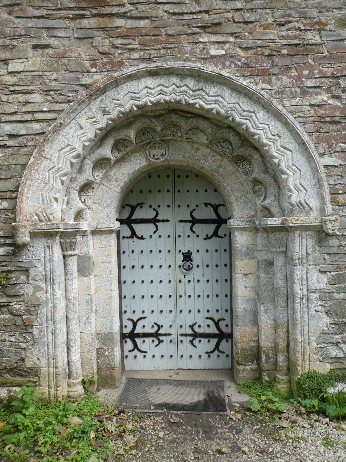
On leaving Falmouth the next section begins at a place called Place which has a large house and rather beautiful old church that is no longer used but is preserved by a hertitage organisation, and nothing else.
The walk around Anthony Head was quite lovely.
We walked through Portscatho without stopping because...
Some lovely people at the village of Durgan had told us about the Hidden Cafe just past Portscatho.
This cafe consists of a shed with outdoor seating only, looking over a beach. The BEST minestrone soup I have ever tasted - a flavour explosion in my mouth!
And cakes, all prepared in an outdoor kitchen. YUM!!
Portloe is yet another tiny harbour village
These minature shetlands decided to walk along the track in front of us, and they were not in a hurry. So cute!
Farmland and narrow roads sunken between high hedges growing over stone walls are challenging to drive on but we were walking. The fields often come right down to low cliff tops and beaches.
Caerhayes Castle is a huge estate with its own beach and lots of farm and fishing cottages now converted for holiday lets. I think the family still live in the mostly 18th and 19th century house that looks like it is modeled on Windsor Castle.
At one of the Caerhayes' beach villages we were mesmerized by dancing waves. Their curved concrete sea wall had created unusual conditions where the waves crashed against it and then rushed back out to meet the next incoming waves.
Mevagissey is a larger harbour town. We got a bit lost in some suburban streets on our way in, but the harbour and old town were interesting.
We bought a coffee mug each from Phillip Gregory in his shop and studio close to the harbour. His work beautifully captures the colours of the water that we have so loved as we walked and which lured me to take thousands of photos.
More low cliffs and fields and woods led us to Charlestown with its old unspoiled harbour, home to square-rigged sailing ships and used for filming Poldark harbour scenes.
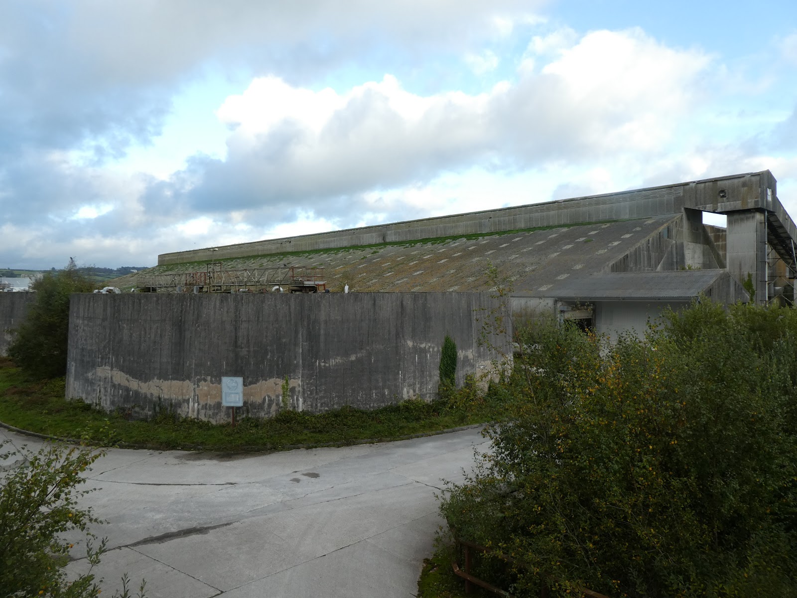
Then there is a rather ordinary section of path between houses and the cliff, beside a long narrow golf course that eventually ends at Par with its ordinary beach and huge ugly abandoned china clay works. These asbestos sheds will a nightmate to remove. Next to them were even more sheds still being used.
We got a bit lost on the way to Fowey and accidentally walked via Menabilly Estate where author Daphne du Maurier lived for many years. This is just the gatehouse at the entrance. We didn't actually see the grand main house.
But we did eat our lunch sheltering under trees from light rain while looking at the two coves seperated by rocks, one with a cottage. This was the setting for du Maurier's book "Rebecca"
This is a daymarker tower on the headland, not a lighthouse, it is used for daytime navigation.
Looking through portholes in a wall
At the view over Fowey.
The shopping area of Fowey.
On the docks at Fowey, another du Maurier reference.
Daphe du Maurier also lived here across the river from the town of Fowey.
Our guide book called the next section from Polruan To Polperro, the "connoisseur's section." Pfft! We don't agree. Scenery-wise we've seen better. Polruan and Polperro are nice historic harbours but no better than others. Polruan was nicely not-touristy. It felt like a real village with its small working docks.
And it rained! We got saturated even with our so-called rain jackets and pants and 'waterproof' boots while trudging up steep hills with no view.
Polperro - the smell of hot chips enticed us into the first pub where we were told they had just finished cooking until dinner time...so cruel.
When we returned to Polperro to start the next walk the weather was much better!
We had a lovely walk to Looe which is situated on both sides of a river mouth. They used to have a resident wild seal called Nelson.
Our walk between Looe and Portwrinkle was another soggy day that left us saturated.
This is the carpark where we had left our car for the day. Luckily we'd parked on the high side of the carpark which the locals call the 'swimming pool' as it floods regularly.
Then the path took us past one the many forts built during the last few centuries to protect the strategically important harbour of Plymouth, some still military and others repurposed into wedding venues and apartments. This one is Tregantle and is still used for military training.
It felt wrong to enter these gates but it is permitted when the firing range is not in use. We entered but left a little further up the hill and walked around the road instead.
We got caught in two dramatic blustery showers that we saw coming at us across the sea
There is a large shack community at Whitsand Bay, lots of tiny houses nestled among shrubs on the steep slope.
The medieval chapel high on Rame Head looked like this just before we climbed up there and had to shelter inside while the weather blew and rained.
Wild ponies grazing around the chapel. This is a mum, her 3 or 4 month old foal and last year's one year old, totally unfazed and ignoring all the people walking around.
Rame Head from afar.
Woodland walking on an old coach road heading toward Plymouth.
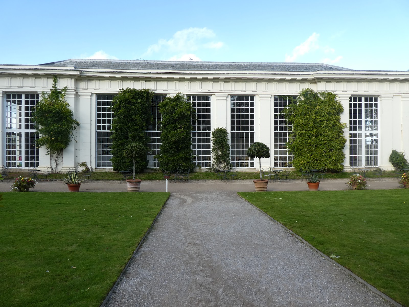
Mount Edgecumbe is a massive estate just across the Tamar River from Plymouth, very pleasant walking.
One of the three ferries we caught during our 13km walk around Plymouth.
The mouth of the entrance to Plymouth is protected by a mile long breakwater with a fort in the middle of the water.
This strange sea creature is at the wharf where the pilgrims left on the Mayflower to settle America 400 years ago next year.
View from the ferry of the hill near the centre of Plymouth -lido aka swimming pool, and up above - a lighthouse, war memorial cenotaph and parkland. Population about 235,000.
Half of the Plymouth walk was very industrial and drab. This is one of the track markers used here.
There were dead wooden boats in dead-end waterways. Strangely impressive.
And a rhinoceros - remembering megafauna fossils.
Numerous marinas with millions of dollars worth of recreational boats. There is a ridiculous amount of money on show here.
An elaborate shelter area overlooking the water at the better side of town, lots of elegant old homes here.
More impressive old wharf-side buildings taken from one of the ferries.
Plymouth marks 672.5kms walked and 24,198 metres of climbing. And time for a rest!


No comments:
Post a Comment