On the rainy days we chose to stay indoors, mostly. We joined the National Trust. This means free entry and free parking at their historic properties. We have already covered what we spent so visits are now effectively free. Excellent value.
Buckland Abbey -We thought we were going to see an old monastry but it was effectively a very early church conversion. When Henry VIII closed the Catholic churches and monastries in the 1500s he let one of his mates, Sir Richard Grenville, buy Buckland Abbey and convert it into a grand house. Then one of Queen Elizabeth I's favourites, Sir Frances Drake bought it. It stayed in his family until the 20th cdntury when it was given to the National Trust.
Sir Frances Drake. This is a larger-than-life plaster cast that was used to create a bronze statue.
Lots of lovely windows and maritime history. A model of Drake's Golden Hind.
The Great Hall with original Tudor floor tiles and ceiling. Some important people would have dined here over the years.
Many even older original details from the church can still be seen.
Sheryl looks tiny inside the enormous barn, originally the tithe barn for the Abbey where the local people would donate one tenth of their harvest for the monks to use.
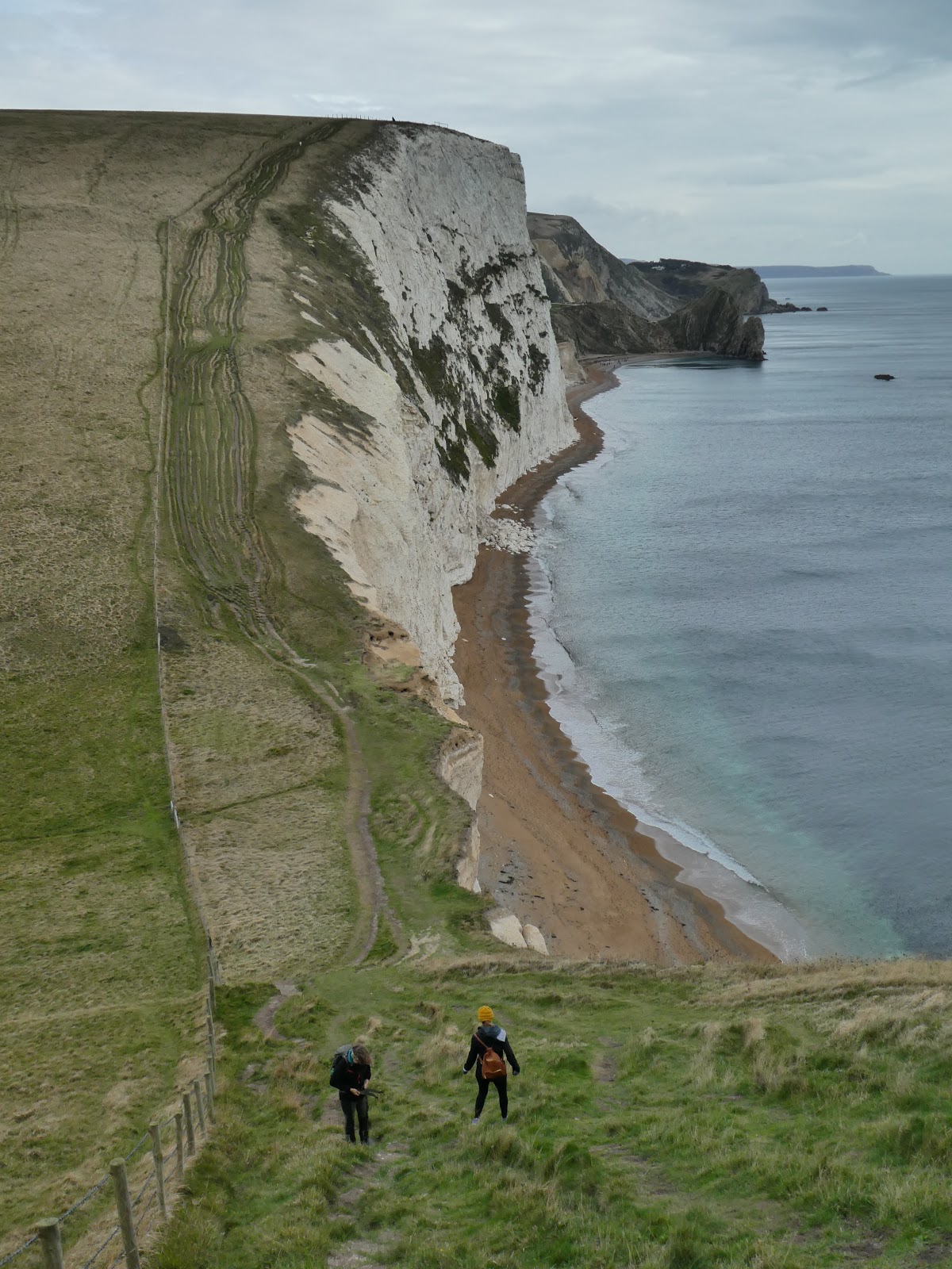
The Abbey once had 22,000 acres of land. Much has been sold off but we went for a walk around the fields and woods for about an hour. We got rained on but it was still a lovely walk.
Cotehele - a Tudor mansion and estate that was the country home for the Edgecumbes of the Mt Edgecumbe estate which we walk through near Plymouth the previous week.
The house is built around a large courtyard.
The great hall full of momentos - armour, weapons, whale jaw bones, even an albatross head.
A peep hole from one of the bedrooms allowed someone to watch the goings-on down in the great hall which was used for gatherings as well as being the main entrance.
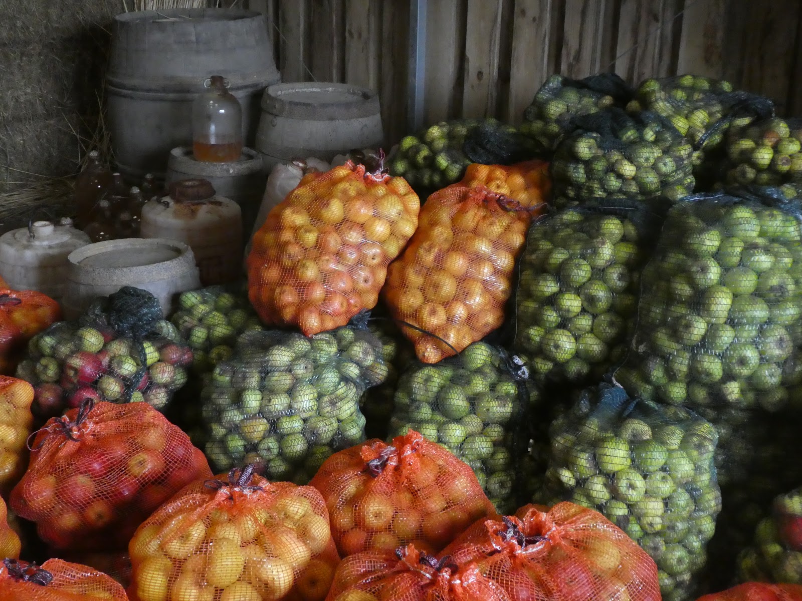
Cotehele also has large gardens and apple orchards. The cider shed was full of the sweet pungent aroma of bags and bags of apples.
"I hold you in the palm of My hand." A living sculpture in the orchard.
We walked through woods to an old water mill that still grounds flour and the quay on the Tamar River which does resemble the one in Tasmania. This was in the mill. I wonder if my Cornish ancestors who migrated to Tasmania in the 1850s were influenced by such posters.
Buckfast Abbey. It was a VERY wet day. We thought we were going to see an old working monastry and see how they grew their own food etc. After a very good value meal in the new cafe and a browse through a history display we learned that they no longer farm, most of the buildings are 20th century including the large church, although it was the site of a monastry before Henry VIII had it destroyed. We did not see a single monk and it was way too wet to do any walking outside.
A la Ronde - a very different house. Built in the 1700s by two women, the house has 16 sides and a light well in the middle. It was larger than I expected with four levels and room for servants.
The above pictures show how it originally looked with a thatched roof. Then in the 19th century dormer windows and bedrooms were installed in the roof space and the roof was tiled. At the moment it looks likes the picture below as they are fixing the leaking roof. But inside it is as normal.
Quirky features such as diamond-shaped windows with shutters that hinge from the middle.
A decoration hanging in the middle of the central room that extends all the way up through the building as a light well with windows in the very top of the roof. The many doors of the encircling outer rooms are reflected in the silver sphere.
The same room taken from one of the doors.
In between each of the outer rooms was a tiny 'wedge room' often used for storage. This one is a tiny library.
The women made this architrave from feathers glued onto boards and installed on an angle so that the dust would not settle on them. No cleaning required, very clever.
This is a picture of the top level up in the roof-light well. The public are not permitted up there as the shell covered walls are too fragile. There are A LOT of shells up there!
The house was passed down to unmarried female family members. It only had one male owner when the woman who had inherited it married and then sold it. When he died it was purchased by an unmarried female relative of the original women and the female ownership tradition recommenced. A la Ronde was filled with quirky decorations and collections. I love the spirit of A a Ronde.