Thursday, October 22, 2020

Wanderment and Floundering at Cradle Mountain

 I have just returned from two days of wanderment and floundering at Cradle Mountain.

Floundering - the exhibition of photos (plus a few extra ones) from my book Floundering: Stories from Cradle Mountain is now showing at the Wilderness Gallery at the Cradle Mountain Hotel until January 31st 2021.

Here we are working hard with our maths and levelling skills to ensure every photo is level at the Wilderness Gallery

It was surprisingly mind-bending and mentally exhausting. I haven't done so much maths in years!

A partial glimpse of the overall end result. You will have to take a wandering trip out to Cradle Mountain to flounder through the photographs and explore your relationship with the wilderness.


We stayed for two nights at the Cradle Mountain Hotel. One day to install the exhibition and one day to wander. 

This curious local pademelon came to say hello at our window balcony. 'Good morning! Please feed me? Aren't I cute? Do you have any treats?' 

"Sorry, but no. People food is very bad for you, but thank you for posing so well for photos. You really are adorable.'

'Slow down...breath out' at the new visitor centre.

Wandering around Dove Lake. Floundering in the beauty of the land, and so, so very grateful for the smaller numbers of people there. It was wonderful to share with relatively few humans and only Tasmania residents, for a change. It felt like it used to feel 15 years ago, before the influx of tourists. But - the hotels were very full, of locals, which was fabulous. The lake sings to you.

Up to Lake Wilks

Flowering heath and new fagus growth.

UP and across the Face Track...touch deep time

Tangled uncomfortably...this is the actual walking track

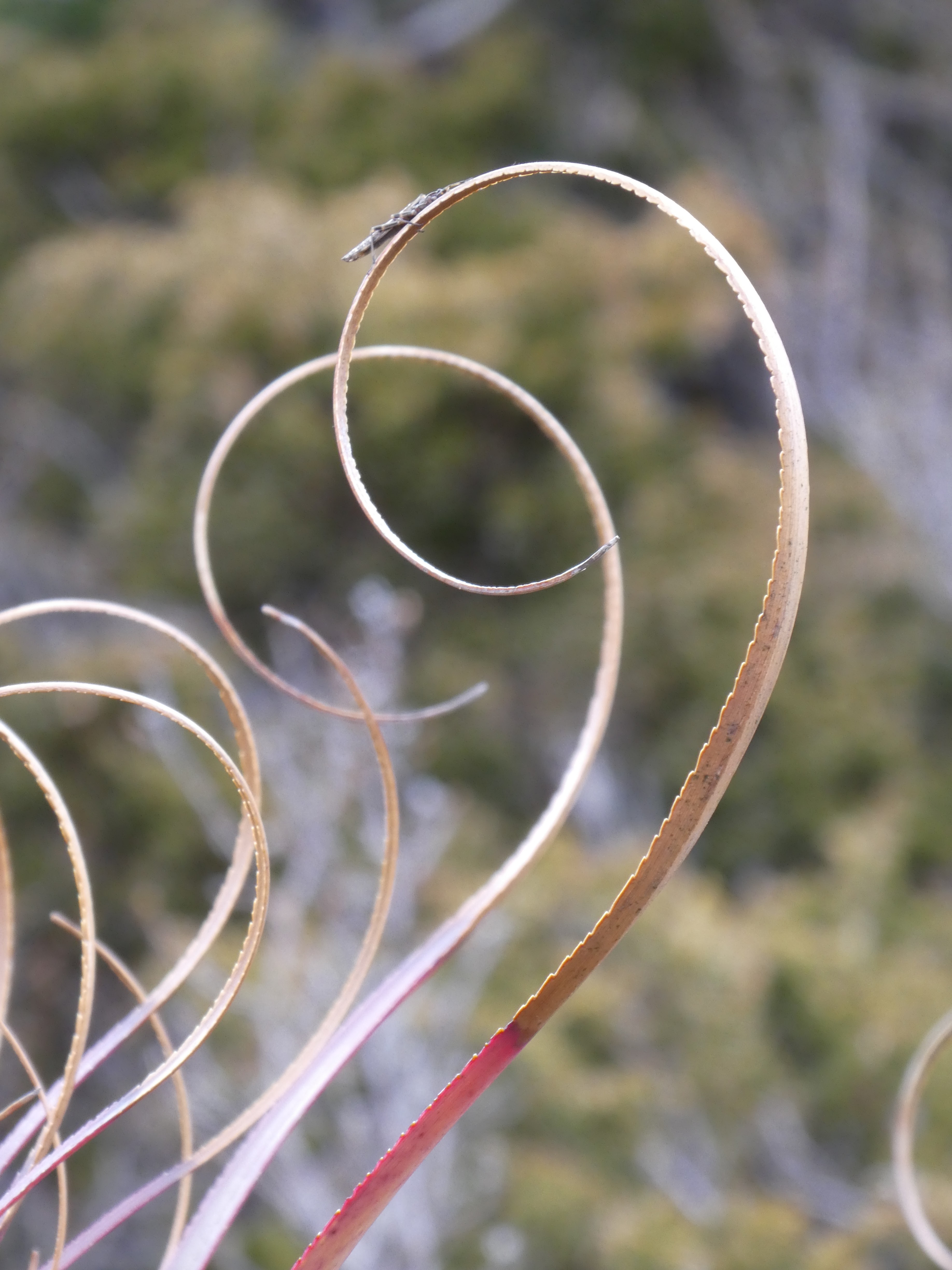
Stop. Look closely. Pandani.

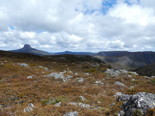
Views to forever, in all directions

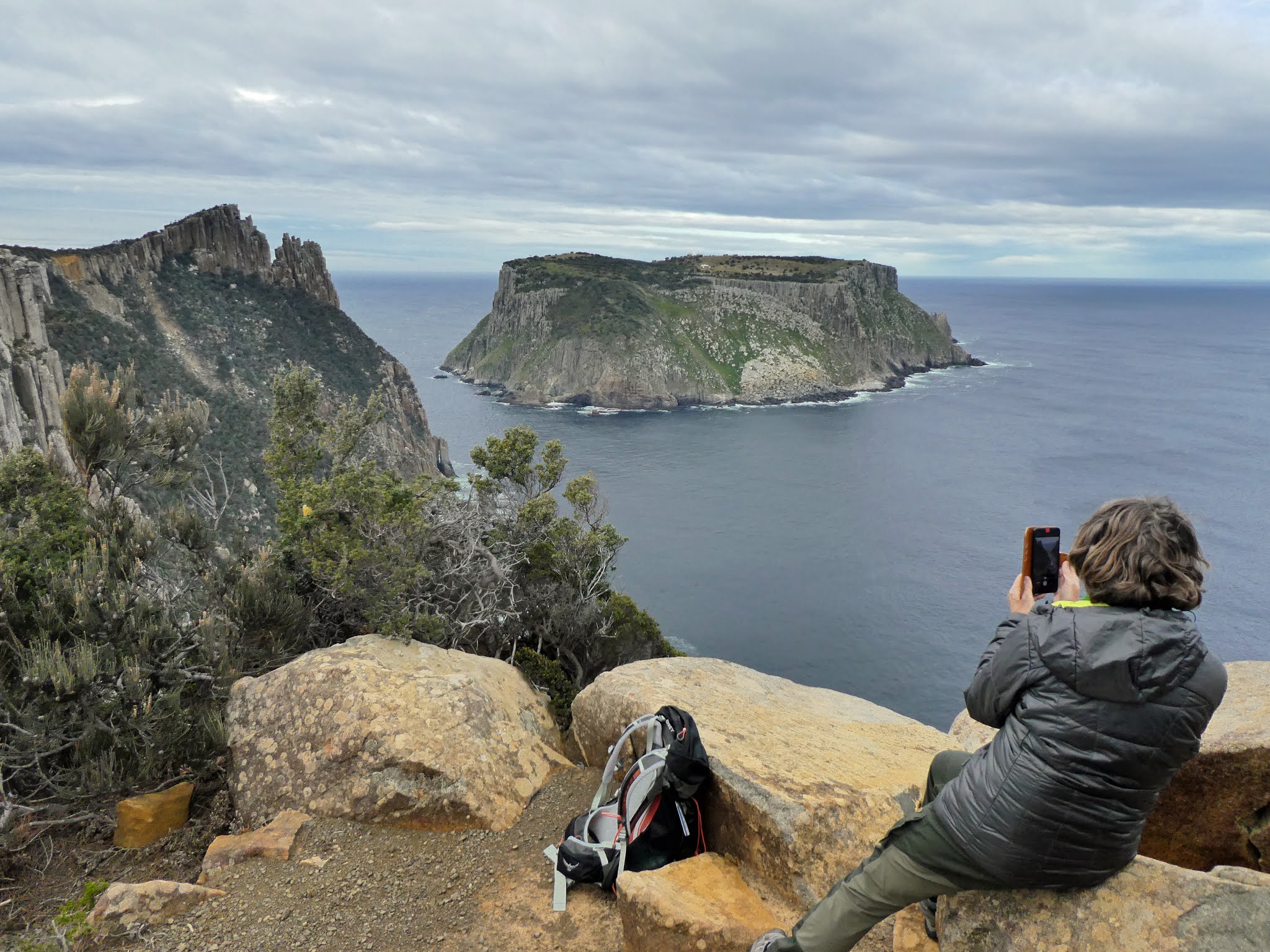
Our lunch-time view.

More friendly locals hoping for some left over crumbs, sitting on a rock two metres behind us...watching, waiting.

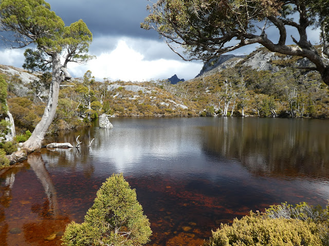
Wombat Pool. Not long before boarding the shuttle bus when light rain began to fall. Six hours of pure wanderment bliss.
        

The Floundering exhibition is showing until January 31st. 


Thursday, September 3, 2020

The Artistry of the Three Capes Track: The final walk and a bonus day

Day four, 14 kms of contrasts. Leaving Retakunna we climb up and over the dark sides of Mount Fortescue.

A place alive with mossy boulder creatures

enchanted by quiet fairy tales

painted by lichens

Sassafras flowers lie on beds of moss

We emerge to walk through the fringe of dry forest metres from the cliff edge with views back to the cape of yesterday.


Today's Cape Hauy has two sets of up and down steps reminding us of our Cornish capes from last year. They are hard work. The sun feels twice the forecast temperature of 15 degrees.

We watch seagulls, seals and a small fishing boat all swirling around a school of fish hundreds of metres below. Sea eagles soar above us again. We have seen wedgetails and sea eagles every day. At the end of Cape Hauy we look down on to the Totem Pole - no rock climbers today.

Then it is a relatively easy one hour walk down through dry forest to Fortescue Bay. Boots off, the soft sand massages the soles of my feet, the cold water is a soothing ice pack. (Thanks to S for this final photo)

Bonus Day. After a hot shower, a bed with sheets and a good sleep, we do one final walk. We walked to Cape Raoul several years ago, so today we walk 8 kms return, to its famous surfing neighbour - Shipstern Bluff. As we perch on the rocks at Shipstern, under the overhanging cliff, it really is like being in the water at the back of a huge ship. Bruny Island and Mt Wellington in the distance.

We watch the surfers and the waves


Cape Raoul in the background

After a couple of mesmerising hours, we walk back to the car and begin our return to every day life.

The Three Capes Track exceeded my expectations. It is not a very hard walk, but is so rewarding in terms of awe and wanderment. 


Tuesday, September 1, 2020

The Artistry of the Three Capes Track : Days 1 - 3

Walking the Three Capes track on Tasmania's southern Tasman Peninsula is like following a four day art sculpture trail - natural sculptures of cliffs and trees, and man-made sculptures in the form of seats and other trail features embedded with stories of the landscape, and of nature and human history.

There are 40 'Encounters' or 'Story Seats' placed along the 48 km trail, their stories are told in the small booklet each walker is given when checking in at Port Arthur, where the boat takes us on a wildlife cruise to the mouth of the harbour, past Point Puer where young convict boys were imprisoned, below cliffs inhabited by cormorants lined up along ledges loftily regarding us beneath them, looking far smarter in their black and white dinner suits than me in a faded red one-size-fits-all poncho for wind and sea spray protection.

Our boat guide talks constantly during the hour long cruise past the golden sands of Crescent Beach, a seal floats lazily in a kelp bed, with views west to the jagged outline of Cape Raoul and east to the lighthouse perched high on Tasman Island. Then we are deposited on the beach in Denmans Cove opposite Port Arthur. 

The first day of walking is an easy 4 km through dry scrub with the sea sighing gently beneath us. We are greeted by Surveyors Hut, with majestic views of Cape Raoul, which we share with seven other walkers who we will meet up with each evening. When the huts are at full capacity they can sleep 48 people, so we are very privileged to have low numbers and a room to ourselves. We sleep on comfy mattresses, carry our sleeping bags and all our own food which we cook on the gas stoves in the shared kitchen area. S beats me at Scrabble after dinner while we listen to one of the other walkers playing a guitar provided by the resident ranger.

Social distancing rules apply.

Day two dawns cool and dry. We walk 11 kms through coastal heathland and dry gum forest. Did you know it can take up to 16 days for a wombat to digest its food and produce the cubed-shaped droppings that inspired these seats?

The cliffs become higher and the views wider.

Tonight's hut nestles in the forest on the cliff top overlooking Munro Bay, the location of four shipwrecks.

Not a bad view from the deck! Cape Huay in the distance.

Sunrise on day three. 

Today we leave most of our stuff at Munro while we walk to Cape Pillar and back, and then on to to Retakunna Hut, a total of 19 kms and a lot of steps and wind. 

Wind sculpted banksia.

My blood runs cold. The longest boardwalk I have ever walked, snakes through teatree marshland, and across the hills for what feels like about two kms, referencing Tasmania's three venomous snakes.


Sitting down seems like a good idea on a windy cliff top.

The ski-jump shape on the cliff top to the left of Tasman Island is called The Blade. It is narrow and steep and we will climb it.

The view from The Blade.
Zooming in on Tasman Island my camera shows me the highest operational lighthouse in Australia, 276 metres above sea level, 29 metres high, automated in 1977, visible for up to 72 kms. The three five bedroom houses once housed the lighthouse keepers and their families.

Awesome - full of awe - describes this place.


After walking to the end of Cape Pillar, we return to Munro, collect our packs and then it is a short walk through the forest to Retakunna, which means creaking trees in the local palawa language. Tonight I beat S at Scrabble while the wind dumps heavy rain outside.