Showing posts with label walking. Show all posts

Tuesday, September 1, 2020

The Artistry of the Three Capes Track : Days 1 - 3

Walking the Three Capes track on Tasmania's southern Tasman Peninsula is like following a four day art sculpture trail - natural sculptures of cliffs and trees, and man-made sculptures in the form of seats and other trail features embedded with stories of the landscape, and of nature and human history.

There are 40 'Encounters' or 'Story Seats' placed along the 48 km trail, their stories are told in the small booklet each walker is given when checking in at Port Arthur, where the boat takes us on a wildlife cruise to the mouth of the harbour, past Point Puer where young convict boys were imprisoned, below cliffs inhabited by cormorants lined up along ledges loftily regarding us beneath them, looking far smarter in their black and white dinner suits than me in a faded red one-size-fits-all poncho for wind and sea spray protection.

Our boat guide talks constantly during the hour long cruise past the golden sands of Crescent Beach, a seal floats lazily in a kelp bed, with views west to the jagged outline of Cape Raoul and east to the lighthouse perched high on Tasman Island. Then we are deposited on the beach in Denmans Cove opposite Port Arthur. 

The first day of walking is an easy 4 km through dry scrub with the sea sighing gently beneath us. We are greeted by Surveyors Hut, with majestic views of Cape Raoul, which we share with seven other walkers who we will meet up with each evening. When the huts are at full capacity they can sleep 48 people, so we are very privileged to have low numbers and a room to ourselves. We sleep on comfy mattresses, carry our sleeping bags and all our own food which we cook on the gas stoves in the shared kitchen area. S beats me at Scrabble after dinner while we listen to one of the other walkers playing a guitar provided by the resident ranger.

Social distancing rules apply.

Day two dawns cool and dry. We walk 11 kms through coastal heathland and dry gum forest. Did you know it can take up to 16 days for a wombat to digest its food and produce the cubed-shaped droppings that inspired these seats?
The cliffs become higher and the views wider.

Tonight's hut nestles in the forest on the cliff top overlooking Munro Bay, the location of four shipwrecks.

Not a bad view from the deck! Cape Huay in the distance.

Sunrise on day three. 

Today we leave most of our stuff at Munro while we walk to Cape Pillar and back, and then on to to Retakunna Hut, a total of 19 kms and a lot of steps and wind. 

Wind sculpted banksia.

My blood runs cold. The longest boardwalk I have ever walked, snakes through teatree marshland, and across the hills for what feels like about two kms, referencing Tasmania's three venomous snakes.


Sitting down seems like a good idea on a windy cliff top.

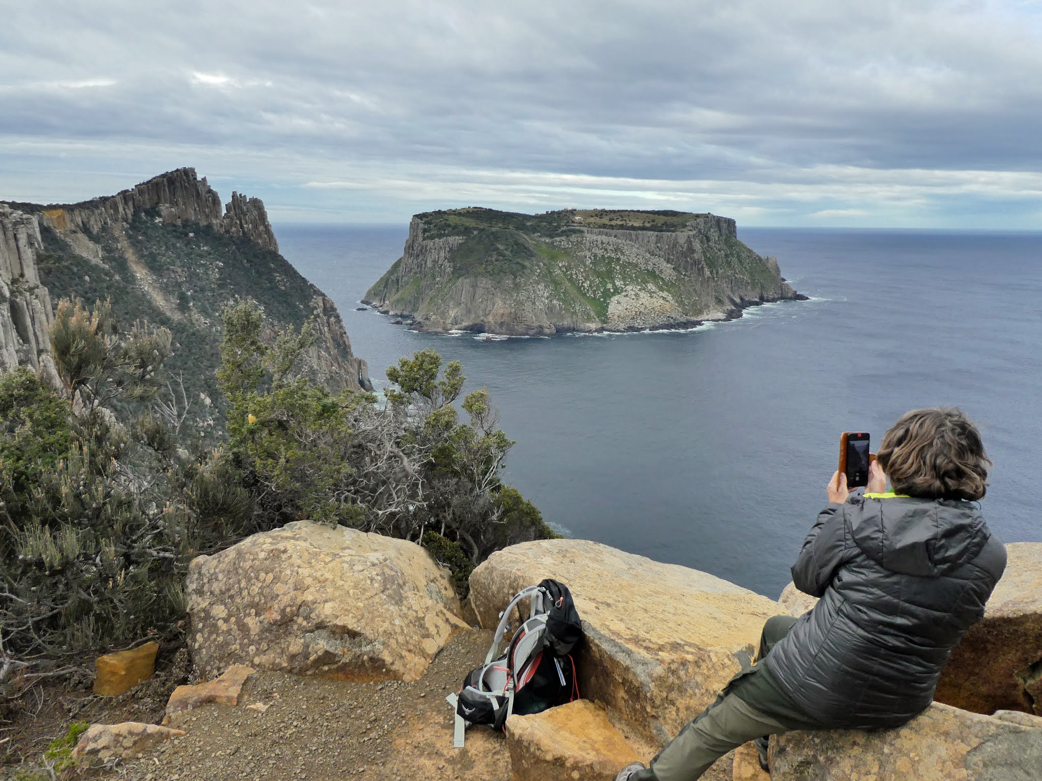
The ski-jump shape on the cliff top to the left of Tasman Island is called The Blade. It is narrow and steep and we will climb it.

The view from The Blade.
Zooming in on Tasman Island my camera shows me the highest operational lighthouse in Australia, 276 metres above sea level, 29 metres high, automated in 1977, visible for up to 72 kms. The three five bedroom houses once housed the lighthouse keepers and their families.

Awesome - full of awe - describes this place.


After walking to the end of Cape Pillar, we return to Munro, collect our packs and then it is a short walk through the forest to Retakunna, which means creaking trees in the local palawa language. Tonight I beat S at Scrabble while the wind dumps heavy rain outside.


Friday, August 21, 2020

Walking in Paradise

It's been a while. Time to start walking and writing again. This morning's little training walk at home - a reminder to be grateful for small things, and that even the small and familiar can be special and new every day.

T'was a bit cold! -1.3 overnight. 2 degrees when I left the house. But the frost on my car - the artistry of nature!

Fortunately, I did not need to drive. My car was wearing an ice-fur coat on its roof.


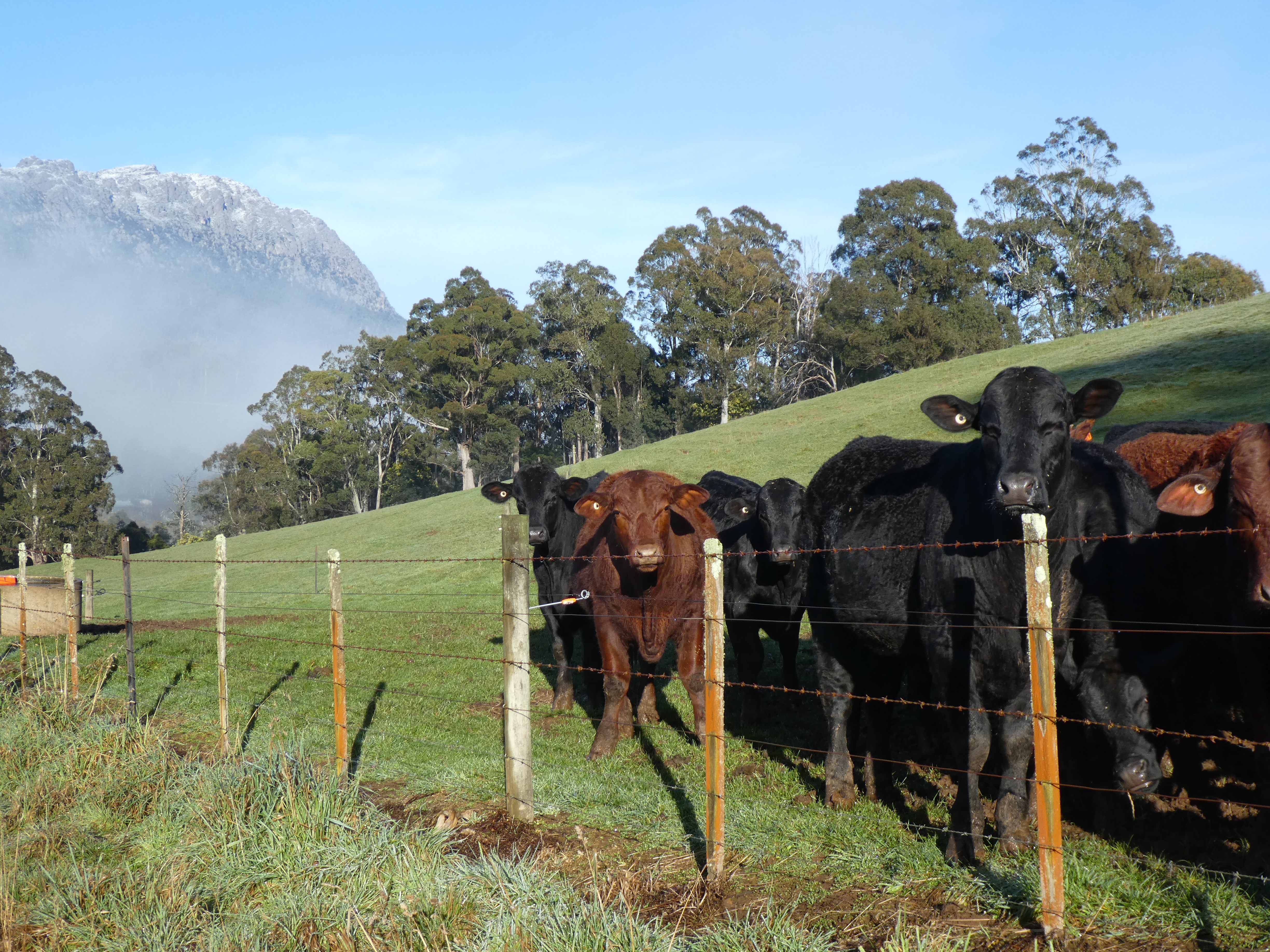
Icing-sugar snow on Mr Roland and curious locals.


Mist in the valleys


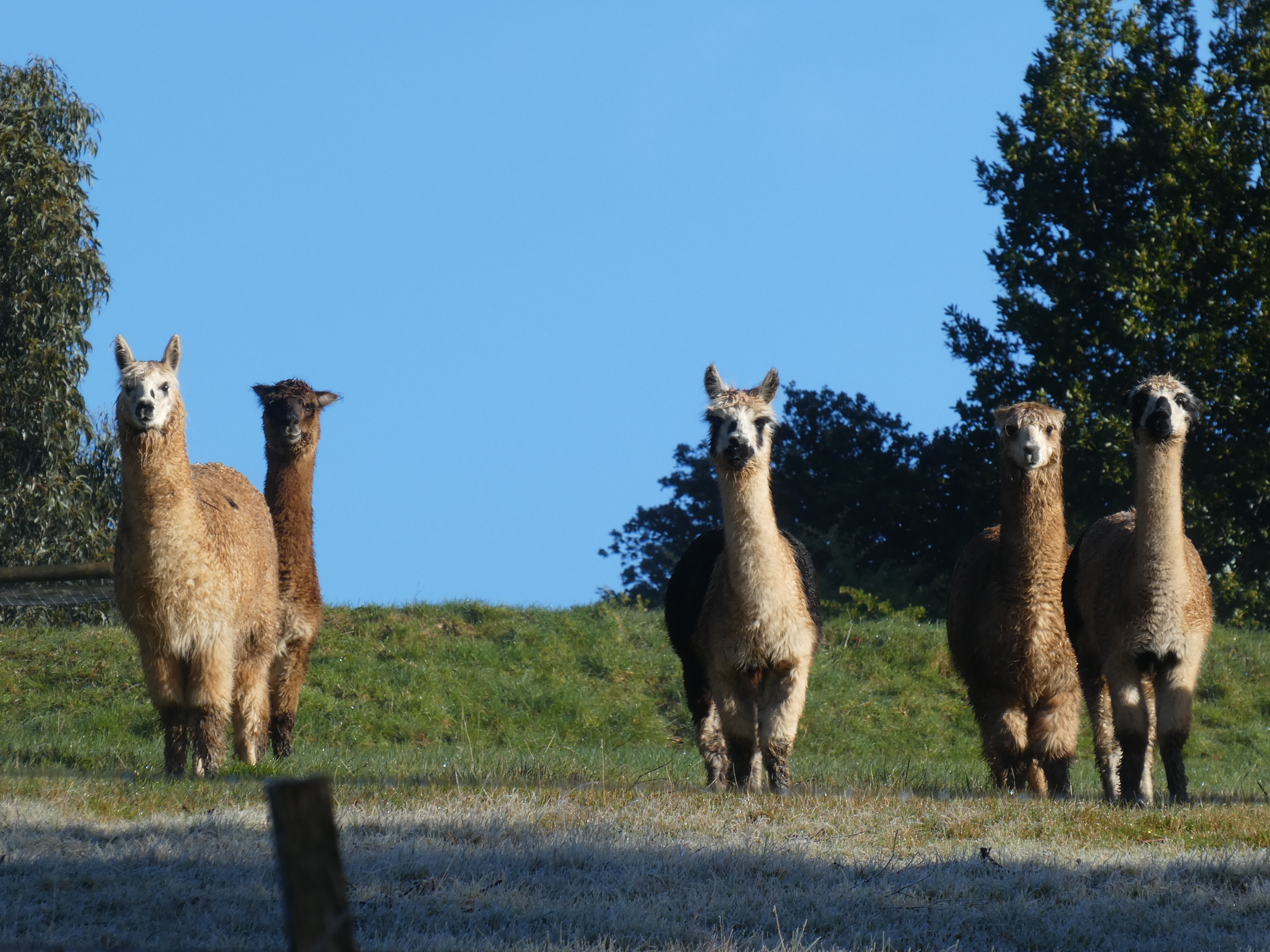
Nervous locals

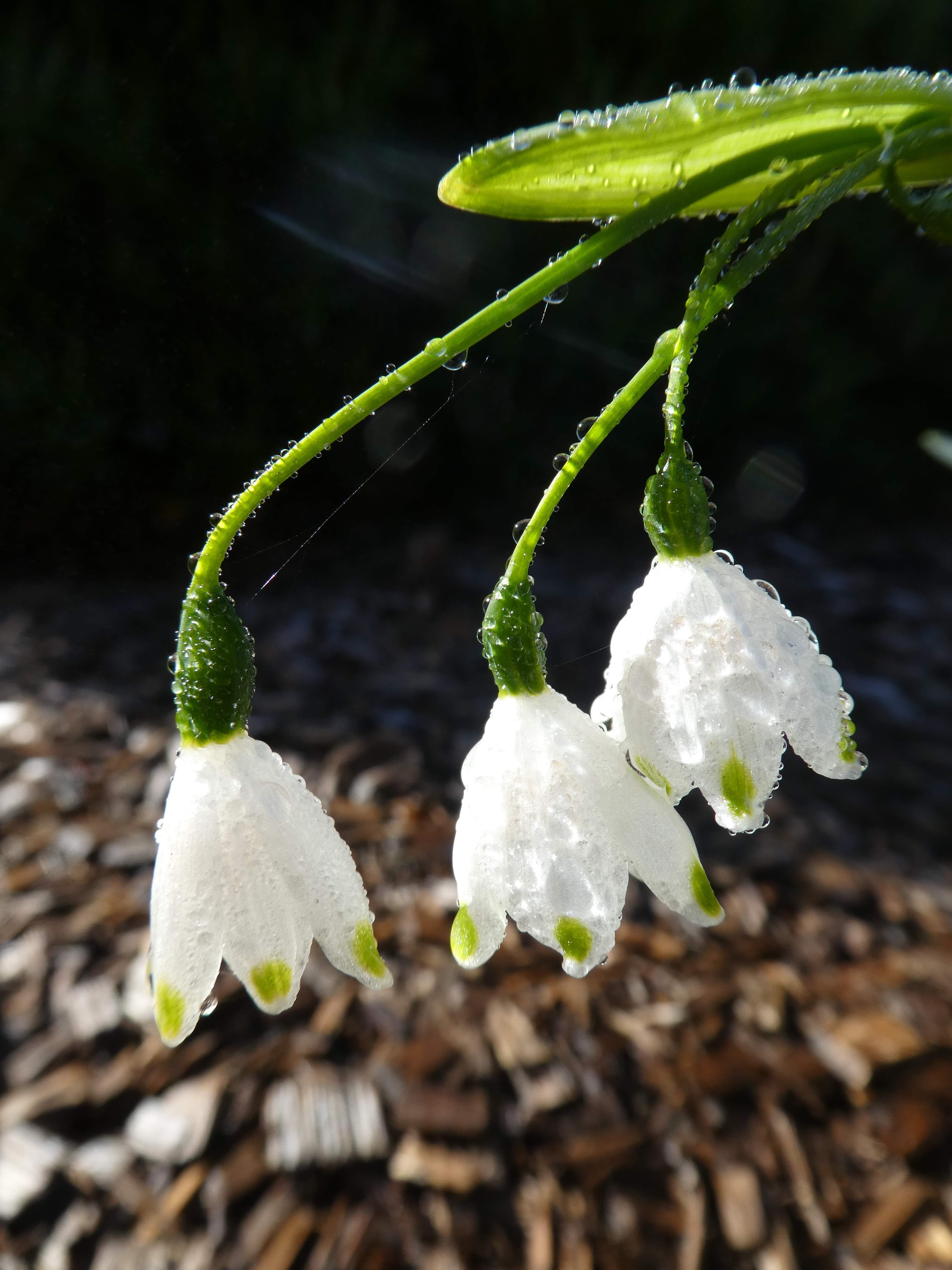
Melting frost


Locals collecting breakfast. Many birds seen and heard; and heard but not seen.


Spring is in the air. Black wattles are in full bloom.


On this day last year, which seems like a century ago, I was in England, on day two of the South West Coast Path. There was no frost, it was hot, we bought icecream on the beach! Click here South West Coast Path and you will see photos to prove it!

In 3 days time, I will be walking Tassie's Three Capes Track way down south on the Tasman Penisula - another coastal path of cliff top walking. I have not really been doing enough walking over the last ten months to be fit enough but it will have to do. The Three Capes is only four days and 48 kms compared with the SWCP's 1000kms and many, many days, but there will be no luggage transfer service, or devonshire teas at cafes, or warm pub meals, or hot showers at the end of each day. We do have to carry our sleeping bags and all our own food, but fortunately, no tent or cooking equipment as the track provides a bunk bed with a mattress and cooking facilities each night, but no hot showers. It will be a challenge but also a privilege to once again be walking multiple days and immersed in wildness.

Today, it was 6 degrees when I arrived home. Balmy! It is spring in my garden.


Friday, June 14, 2019

More training - mountains, forests and beaches

Back in May, one fine day - sunny, cool and no wind - I went for a solo walk up Mt Vandyke - the mountain beside Mt Roland, near my home. Vandyke is a little shorter than Roland but it is still a very decent hill climb to get to the top. Perfect place for lunch.
There are some seriously weird rock formations up on top of Vandyke. They are all conglomerate, a lumpy sedementary rock that looks like someone cemented thousands of round river stones and pebbles together into strange sculptures. Quite different rock to Cradle Mountain and its neighbours. Those snow-capped mountains on the horizon are the ones you walk by along the Overland Track, including Mt Ossa, Tasmania's highest.
When Kate and Gustav Weindorfer honeymooned in a tent on top of Mt Roland in 1906, this is the view of Barn Bluff and Cradle Mountain that they would have seen. Cradle looks very different from this angle compared with the commonly photographed view from Dove Lake.
I am loving this training! Over the Queens Birthday long weekend, I went east. To the Pyengana Dairy Farm cafe. These are BIG scones. Can I do it?
Yes! I can! But only just.
S and I had just finished a day of walking at the Blue Tier, in north-east Tasmania. At times along the Wellington Creek circuit, we felt like we were in an English wood.
This is a myrtle tree, but it reminded us of an oak.
A beautifully distorted view
Through ice from a frozen pool.
Then, before the scones, a couple of kilometres in the ferns along the river at Halls Falls.

Natures art work - tannin foam swirls.
The previous day - a totally different walk at the Bay of Fires. We spent about five hours wandering along the beach, trying to follow almost non-existent tracks through scrub over headlands, along a long white cresent beach and two secluded coves. There were footprints all over the beach but the only human footprints were our own.
Seal hides where Aboriginal women used to sit waiting, hunting for seals.
Morning tea beside a bird-abundant lagoon. Calm, still - reflections! More art work.

Could there be a more perfect way to train for a long walk?
"The rhythm of walking generates a kind of rhythm of thinking, and the passage through a landscape echoes or stimulates the passage through a series of thoughts...the mind is also a landscape...walking is one way to traverse it." Rebecca Solnit